With one of the lowest population densities in the EU (around 8-9.5 inhabitants per square km) and two times the size of Andorra, Las Loras Geopark has a great geological heritage turned into beautiful landscapes through the action of water and time.
The geopark has plenty to offer to the visitor, alongside with four natural park network members that are partly or fully contained within it. Here it’s my pick of 11 highlight sights in Las Loras. You can find more travel and practical information in my guide to Las Loras Geopark.
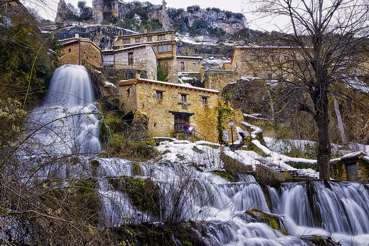
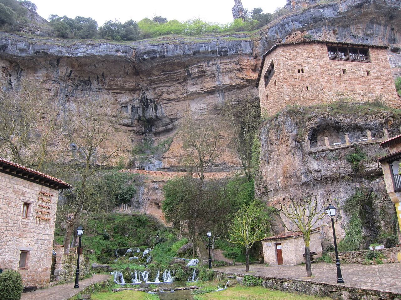
1. Orbaneja del Castillo
With around 50 inhabitants and placed within the Natural Park of Upper Ebro and Rudrón, Orbaneja del Castillo it’s probably the most touristic village on Las Loras (and a very popular destination in Burgos), because of its waterfall, its traditional arquitecture along with the spectacular landscape of the Ebro Canyon.
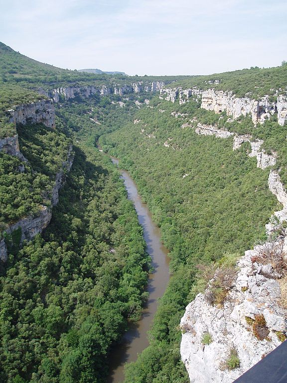
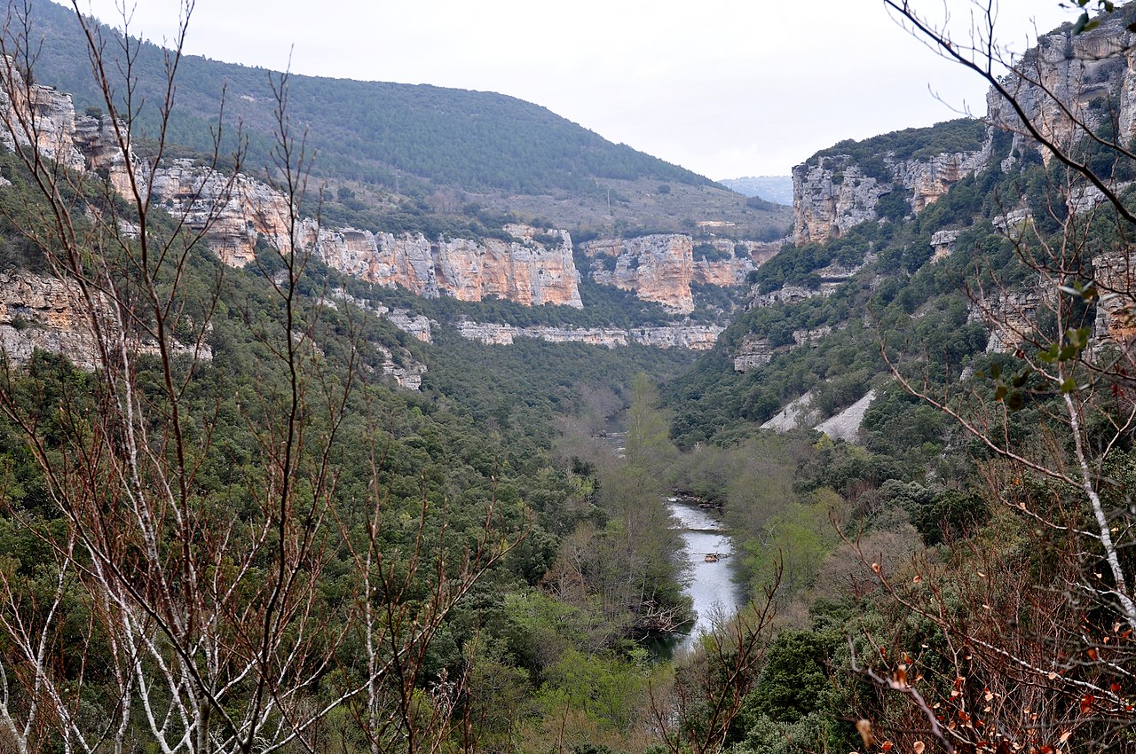
2. Ebro Canyon
The Ebro is the longest river running entirely within Spain. Its source is located in the Cantabria province, not far from the geopark border, from where it flows through all Northern Spain until it discharges into the Mediterranean Sea in the province of Tarragona. And as it flows through Las Loras it shapes an impressive canyon whose depth is greater than 200 metres at some points.
There are some small villages on and near the canyon that worth a visit (like Orbaneja del Castillo, Pesquera de Ebro or Escalada). Leisure activities you can enjoy include hiking, water activities on the river and bicycling.
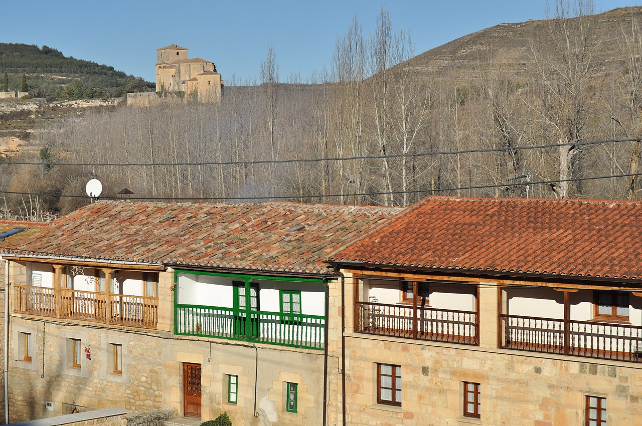
3. Sedano
Capital of the Sedano Valley and with more than 150 inhabitants Sedano is the most populated village in the east of the geopark. That is why the “Miguel Delibes” visitor’s centre is placed here (and named after the spanish writer Miguel Delibes who used to spend their summers here). Tourist attractions include a small waterfall under the bridge, the local architecture (pictured), the already mentioned visitor’s centre and middle-age tombs from the tenth century carved in stone.
.jpg)
4. Pozo Azul (Blue Pit)

Not placed within the geopark but quite near its eastern border, Pozo Azul is another must-see and a popular destination in the region. It can be reached on foot from the small village of Covanera, which you should visit if you like the traditional architecture of Ebro Canyon / Sedano Valley area.
Pozo Azul (“blue pit”) is a spring, in fact an inundated cave, named after the color of its transparent water. This blue is caused due to the diffraction of light in the huge depth of the pit. On the geological side the length of the cave remains unknown, with 13 600 metres already explored, making it the longest of its type in Spain. The temperature of the water ranges between 9ºC and 11ºC along the year.

5. Ayoluengo Oil Field
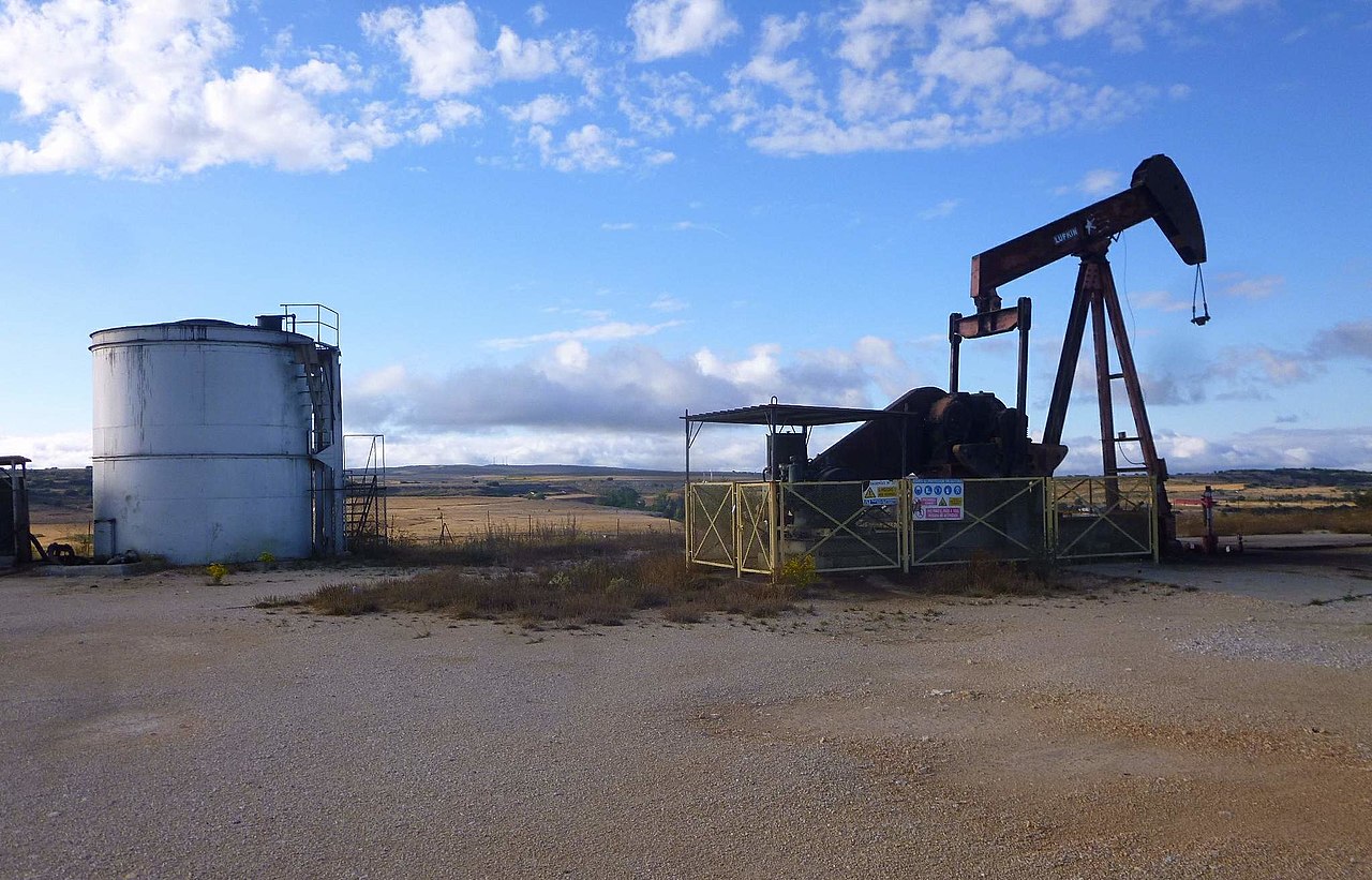
_07.jpg)
Western of our previous locations, between the villages of Ayoluengo and Sargentes de la Lora, the Ayoluengo Oil Field is placed, which is (as of July 2020) the only oil field in continental iberian peninsula. Petroleum was discovered here in June 6, 1964 although production didn’t begin until 1967. Between 1964 and 1990 fifty-two wells were drilled. It produced around 160-250 barrels per day on its last years, ceasing in 2017 after 50 years. In 2018 the Ayoluengo Oil Field was definitely closed by the Government of Spain with a cumulative production of less than the 20% of the proven reserves of the field.
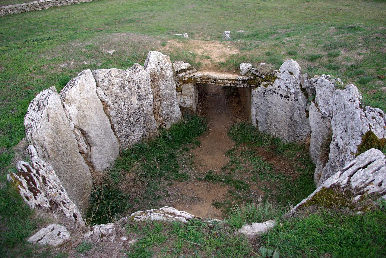
There is a neolithic dolmen called “Dolmen de la Cabaña” not far from the oil field and the villages. Its age is believed to be (according to archaeological research) about 5000 years.
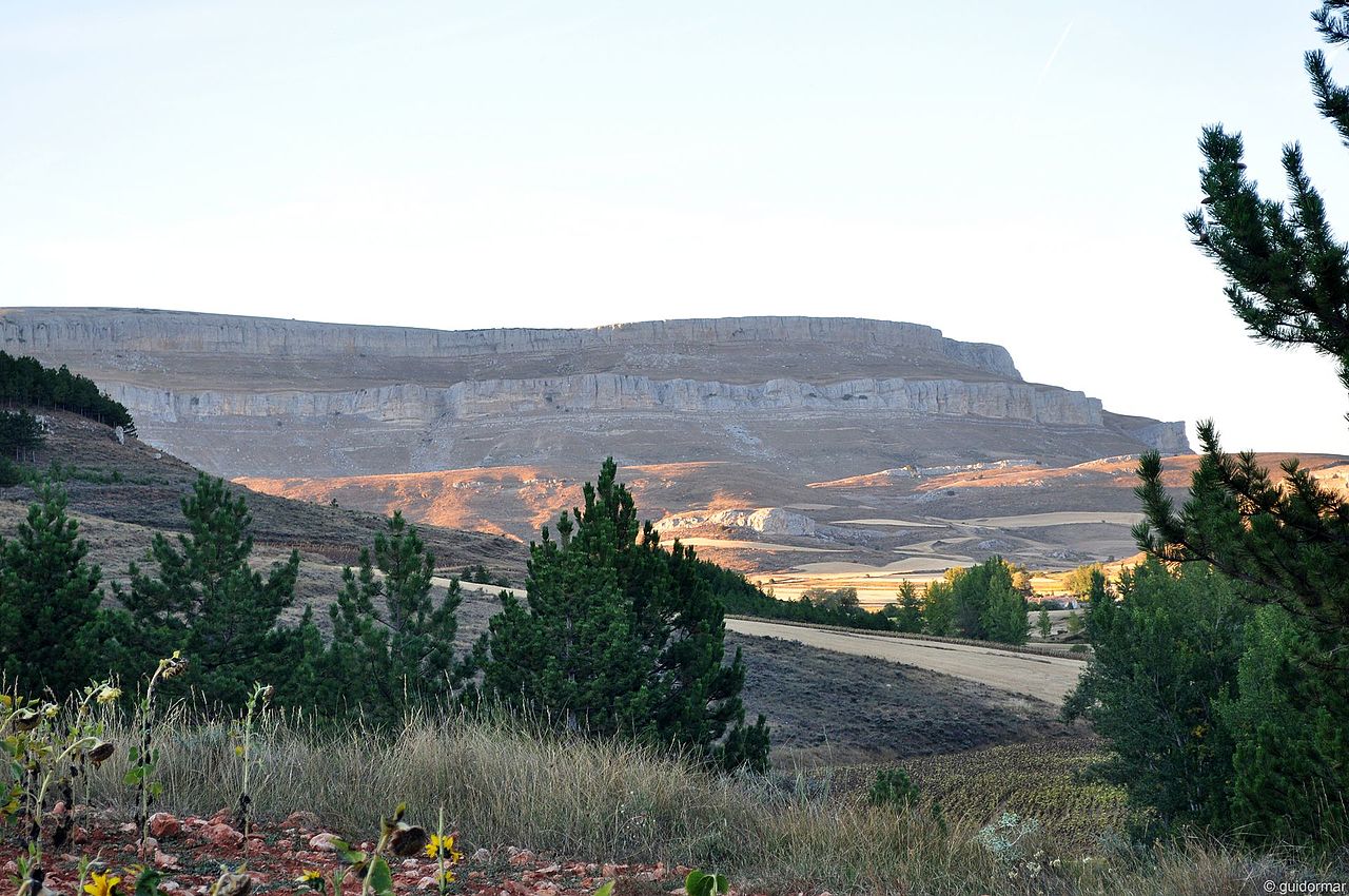
6. Rudrón Canyon
Placed in the heart of the Tozo region (still in the East of Las Loras Geopark), the Rudrón Canyon has been perforated along millions of years by the Rudrón River, whose source is located in Basconcillos del Tozo, the capital of the municipality. The Canyon itself starts in Barrio Panizares and ends in Valdelateja, but the most popular part it’s between Hoyos del Tozo and Moradillo del Castillo. This river eventually flows into the Ebro River.
A great variety of fauna can be found in the canyon, with birds like griffon vulture, Bonelli’s eagle and golden eagle, and mammals like otters, badgers and wolves. Hiking is a popular activity that can be done through footpaths in the bottom of the gorge.
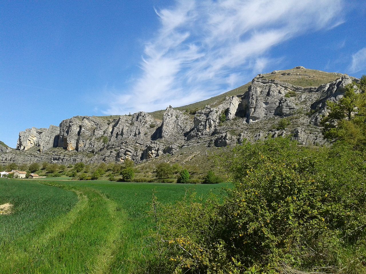
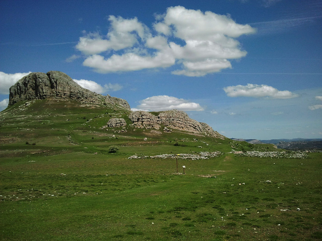
7. Peña Amaya
Populated from the Bronze Age until the XIV/XV century, Peña Amaya has an amazing history. The mountain arises abruptly from the fields of the “Meseta Norte” (northern plateau) of Iberia making it a perfect watchtower which combined with its steep cliffs, a few stone walls and one unique gate through a narrow trench made Amaya an impregnable city.
Only a few ruins and rocks last from its past, vaguely implying the shapes of some streets and buildings. With a maximum elevation of 1377 metres, Peña Amaya is a popular destination for locals and can be easily accessed from the village of Amaya that lies on its roots. This is a perfect destination for hiking activities as well as an unbeatable scenic viewpoint of the “Meseta Norte” whose border it limits.
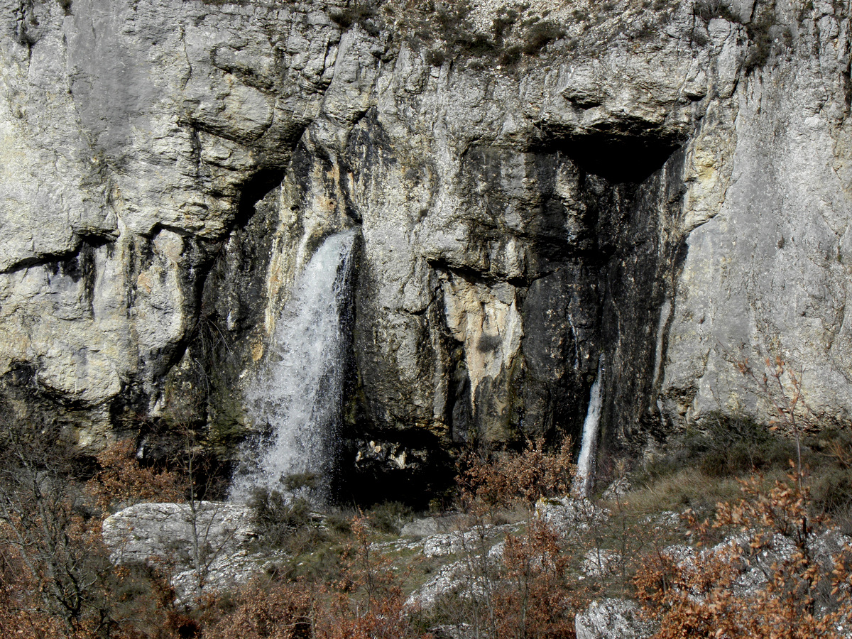
8. Yeguamea Waterfall
The small village of Fuenteodra is located near the Odra river sources (“fuente” in spanish means “source”), which can be reached and toured on foot from the village. The most famous source is Fuente Manapites because the violence of the water as it springs shake very small rocks, making the visual effect that the water is boiling. This effect usually doesn’t take place on dry season, as there is not enough water.
Quite close to the Odra sources (actually, it’s the first sight on the footpath to them) is located Yeguamea, one of the most original waterfalls in the geopark, in which the water springs directly from a natural stone wall. There are two smaller waterfalls called “potrillos”, one left of Yeguamea and one right (pictured above). This is another popular place for the geopark locals.
9. Rebolledo de la Torre
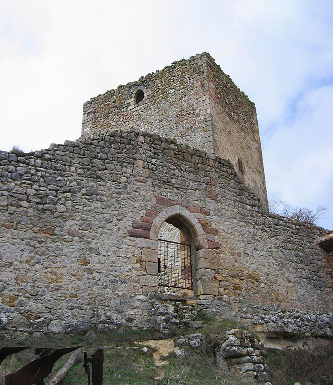
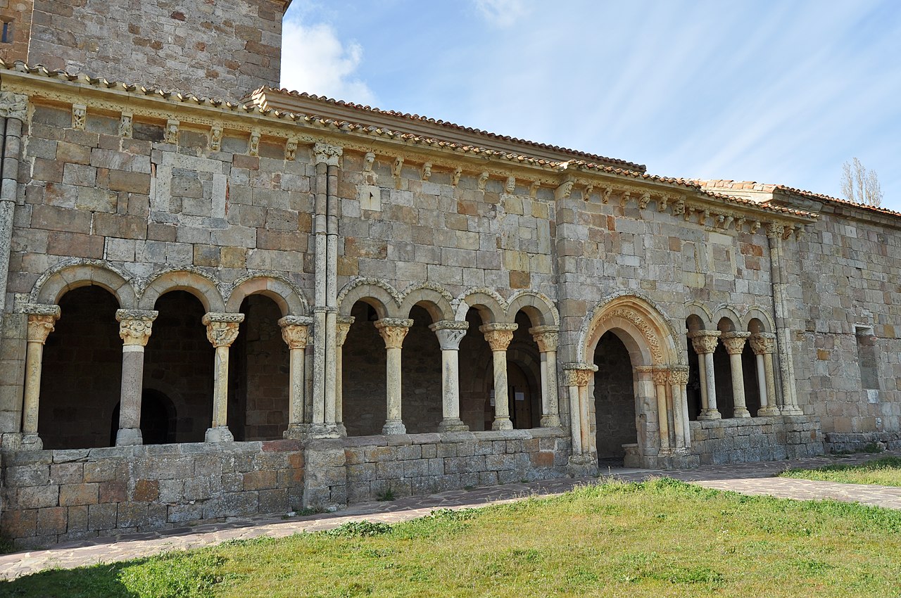
Rebolledo de la Torre has a very important and interesting cultural and architecture heritage. Placed on the western border of Burgos province, around 10 kilometres north from Peña Amaya and with less than 50 inhabitants it’s known for two landmarks: Its castle and its church.
Although probably built upon previous structures the current castle building dates from the XIII-XIV century. It consists in one main tower surrounded by one external stone wall which only has one small gate. The church of Rebolledo is placed next to the castle and its gallery (built in 1186) it’s considered to be one of the most beautiful jewels of the romanesque period that can be found in Spain.
.jpg)
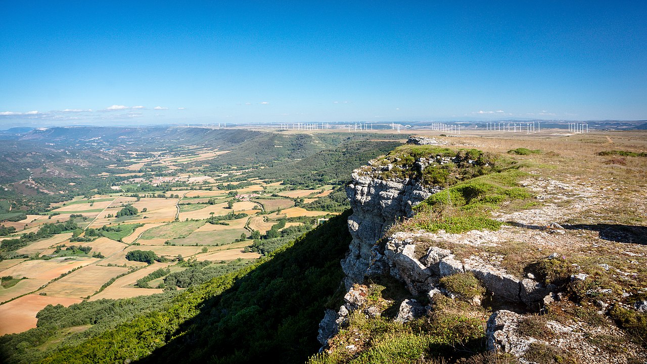
10. Las Tuerces
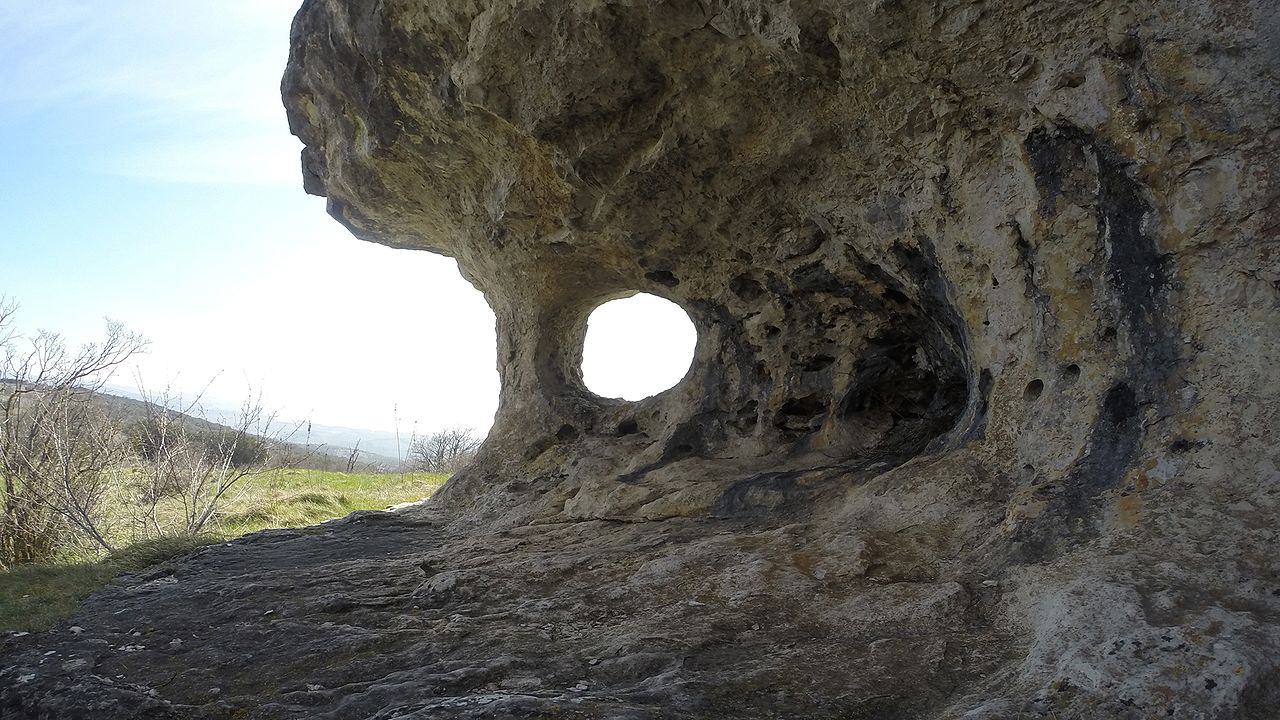
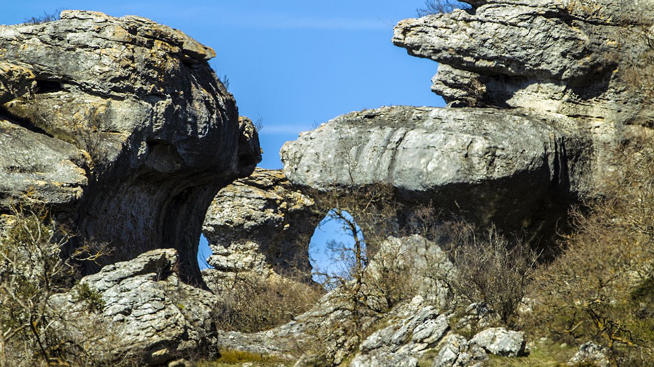
Placed in the province of Palencia, near the eastern border with Burgos, Las Tuerces is a Natural Park within Las Loras Geopark. Erosion through millions of years has built rocks with fascinating irregular shapes (pictured) and the Horadada Canyon. Las Tuerces can be reached easily on foot from the nearby village of Villaescusa de las Torres. The Horadada Canyon flows between this village and Olleros de Pisuerga, where you can see their famous rock-cutted hermitage.
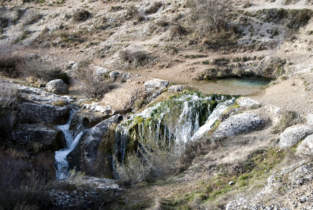
11. Covalagua
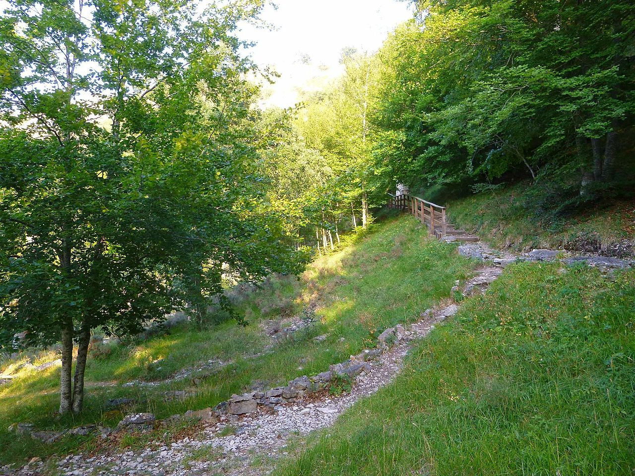
Also located in the province of Palencia, the Covalagua Natural Park is another natural park located inside Las Loras Geopark. Its main attractions are close one to another and can be accessed from the small village of Revilla de Pomar (following the road).
The first attraction (and probably the main one) it’s the source of the Ivia river (referred as Covalagua by the locals) which it’s located in a cave from which it flows through small waterfalls formed due to the tufa sedimented by the river along the years. There are footpaths (pictured) and walkways so you can wander through the beautiful source and its surrounding forest.
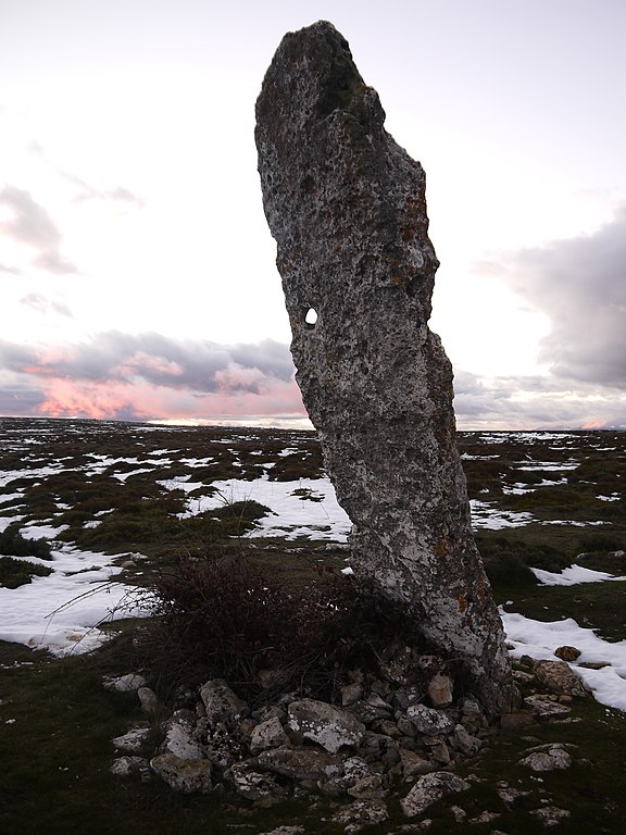
Other things you can do in this Natural Park are visiting a karstic cave called “Cueva de los Franceses”, a prehistoric menhir called “Canto Hito” and a scenic viewpoint (Mirador de Valcabado) from which you can see the Valderredible Valley of the Cantabria province.
There are still many other places to visit and things to do in Las Loras Geopark. Check the guide!.